Property Record
327 Dahlonega St, Cumming, GA 30040
NEARBY LISTINGS FOR SALE OR LEASE
Property Detail
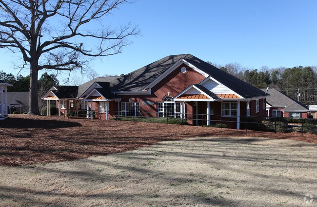
327 Dahlonega St
C15-131
Tanyard Oaks Office Park
Officecondo
3-1 1250 UN 1702B TANYARD OAKS OFF PARK
X
Forsyth
13117C0134F
Georgia
2024
0.01 AC
2025
N Fulton/Forsyth County
130409
Atlanta
1,190 SF
Atlanta-Sandy Springs-Roswell, GA
DEMOGRAPHICS near 327 Dahlonega St
1 Mile
3 Mile
5 Mile
2024 Total Population
3,715
38,480
101,436
2029 Population
4,342
44,897
118,253
Pop Growth 2024-2029
+ 16.88%
+ 16.68%
+ 16.58%
Average Age
41
40
39
2024 Total Households
1,349
13,838
34,815
HH Growth 2024-2029
+ 17.20%
+ 16.78%
+ 16.66%
Median Household Inc
$60,192
$94,165
$111,440
Avg Household Size
2.60
2.70
2.90
2024 Avg HH Vehicles
2.00
2.00
2.00
Median Home Value
$269,702
$370,333
$421,733
Median Year Built
1996
2001
2002
Nearby Places
Map Layers
Map Styles
 Street
 Aerial
- Restaurants
- Banks
- Shops
- Fitness
- Groceries
SALE & LEASE HISTORY
LISTING DATE
SALE/LEASE

Nov 15, 2022
For Lease
Jun 26, 2018
For Lease
Jul 01, 2020
For Lease
Jan 09, 2025
For Lease
Feb 26, 2021
For Lease
Nearby Properties
Address
Land Use
TOTAL SIZE
Lot Size
Zoning
Address
Land Use
TOTAL SIZE
Lot Size
Zoning
581,433 SF
31.45 AC
INST
Address
Land Use
TOTAL SIZE
Lot Size
Zoning
8,848 SF
15.75 AC
PUD
Address
Land Use
TOTAL SIZE
Lot Size
Zoning
10.82 AC
PUD
Address
Land Use
TOTAL SIZE
Lot Size
Zoning
10.57 AC
PUD
Address
Land Use
TOTAL SIZE
Lot Size
Zoning
15,081 SF
27.53 AC
R3
Address
Land Use
TOTAL SIZE
Lot Size
Zoning
208,496 SF
23.61 AC
R3
Address
Land Use
TOTAL SIZE
Lot Size
Zoning
312,095 SF
28.86 AC
PSC
Address
Land Use
TOTAL SIZE
Lot Size
Zoning
302,599 SF
35.89 AC
R3
Address
Land Use
TOTAL SIZE
Lot Size
Zoning
15,600 SF
21.98 AC
R3
Address
Land Use
TOTAL SIZE
Lot Size
Zoning
173,374 SF
32.90 AC
CBD
Address
Land Use
TOTAL SIZE
Lot Size
Zoning
6.49 AC
PUD
Address
Land Use
TOTAL SIZE
Lot Size
Zoning
171,065 SF
16.22 AC
CBD
Address
Land Use
TOTAL SIZE
Lot Size
Zoning
149,540 SF
43.76 AC
INST
Address
Land Use
TOTAL SIZE
Lot Size
Zoning
24.78 AC
INST
Address
Land Use
TOTAL SIZE
Lot Size
Zoning
62,085 SF
28.70 AC
INST
Address
Land Use
TOTAL SIZE
Lot Size
Zoning
120,750 SF
9.37 AC
INST
Address
Land Use
TOTAL SIZE
Lot Size
Zoning
65,364 SF
15.29 AC
PSC
Address
Land Use
TOTAL SIZE
Lot Size
Zoning
152,562 SF
12.80 AC
R3
Address
Land Use
TOTAL SIZE
Lot Size
Zoning
159,291 SF
29.19 AC
MU
Address
Land Use
TOTAL SIZE
Lot Size
Zoning
127,940 SF
14.30 AC
HB
Address
Land Use
TOTAL SIZE
Lot Size
Zoning
99,232 SF
Address
Land Use
TOTAL SIZE
Lot Size
Zoning
109,856 SF
12.94 AC
CBD
Address
Land Use
TOTAL SIZE
Lot Size
Zoning
267,180 SF
31.01 AC
INST
Address
Land Use
TOTAL SIZE
Lot Size
Zoning
111,194 SF
13.53 AC
NS
Address
Land Use
TOTAL SIZE
Lot Size
Zoning
85,398 SF
Address
Land Use
TOTAL SIZE
Lot Size
Zoning
268,761 SF
55.50 AC
INST
Address
Land Use
TOTAL SIZE
Lot Size
Zoning
60,392 SF
1.66 AC
CBD
Address
Land Use
TOTAL SIZE
Lot Size
Zoning
89,312 SF
7.50 AC
M1
Address
Land Use
TOTAL SIZE
Lot Size
Zoning
95,926 SF
34.26 AC
HB
Address
Land Use
TOTAL SIZE
Lot Size
Zoning
175,237 SF
2.13 AC
CBD
The World's #1 Commercial Real Estate Marketplace
Connect with us
© 2025 CoStar Group
The information above has been obtained from sources believed reliable. While we do not doubt its accuracy we have not verified it and make no guarantee, warranty or representation about it. It is your responsibility to independently confirm its accuracy and completeness. Any projections, opinions, assumptions, or estimates used are for example only and do not represent the current or future performance of the property. The value of this transaction to you depends on tax and other factors which should be evaluated by your tax, financial, and legal advisors. You and your advisors should conduct a careful, independent investigation of the property to determine to your satisfaction the suitability of the property for your needs.